THE BRIDGES OF ARTSAKH
Older Bridge of Karavaz (Khudaperin)
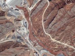
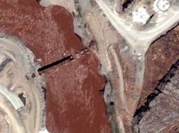
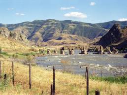
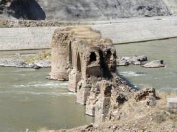
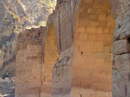
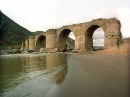
The older bridge of Karavaz (5th to 7th centuries) lies over the river Arax, at the foot of Mount Diri in Kovsakan District (present-day Kashatagh District), Republic of Artsakh (RMK: Republic of Mountainous Karabakh), at an altitude of 248 metres above sea level.
One of the earliest records mentioning this monument dates from the 13th century: “…Aghahej [District], that is crossed by the river Aghvano and reaches the bridge of Karavaz…” __11. Orbelian, Stepanos. History of Siunik. Yerevan, 1986, p. 263 (the original in Armenian). The available Arabic and Persian sources refer to the bridge by the names Hudaferin and Khudaperin.
One of the first scholars known to have studied the monument wrote the following in the early 1980s: “The upper bridge, which bespeaks high antiquity, is built of entirely finely-dressed stone. It has nine spans with their piers resting on natural rocks. Four of the span arches are preserved standing, the other five lying in ruins…” __32. Barkhutariants, M. Artsakh. Baku, 1895, p. 62 (the original in Armenian).
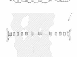
Between 1975 and 1977—for the first time in its history—the older bridge of Karavaz was measured within the framework of the Soviet-Iranian joint project of revealing the power generation potential of the river Arax. According to measurement results, the bridge of 11 spans has a length of 130 metres and a width of 6 metres, its height above water level reaching 12 metres. __33. Mamedzade, K. Building Art of Azerbaijan. Baku, 1983, p. 47 (the original in Russian). The foundation of the older bridge of Karavaz is attributed to the ancient world, and even to the times of the Achaemenid Empire.
Geographical coordinates: N 39°09°25.39,°° E 46°56°15.17.°°
