THE BRIDGES OF ARTSAKH
Bridge of Khaghkhagh
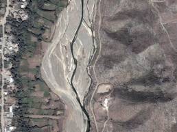
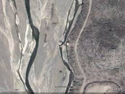
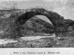
The bridge extends over the river Zakam, at the eastern extremity of Yankhli Village in present-day Touz District—Zakam District of Northern Artsakh, a region that suffered deportation of its Armenian population in 1988 and has been annexed to Azerbaijan since then—at an altitude of 110 metres above sea level. The period of its construction remains unrevealed, but the building and finishing peculiarities of the lower stonework of its piers are typical of the early Middle Ages, which allows us to trace it back to the first centuries of the Common Era, when Khaghkhagh still served as a place of winter residence for the Armenian kings of the Arshakid Family (66 to 428). Later the bridge repeatedly underwent overhaul, thanks to which, it was preserved standing until the early 20th century.
Folklorist Sargis Kamalian, who saw the bridge in 1890, writes the following about it: “…The bridge has three immense arches and broad-faceted walls which are hollow and serve as warehouses. Its middle pier has doors from two sides. The bridge is in a state of disrepair and does not function… …the place is called Kh[e]nnalu or Kh[e]lkhana.”__11. Yeghishe Charents Art and Literature Museum: Sargis Kamalian Fund, copy-book No. 1, VI-11, p. 35 (the original in Armenian). A photograph showing the bridge as standing can be found attached to an anonymous article in Russian entitled Studies of the History of Azerbaijan (“Очерки по истории Азербайджана”). In: Proceedings of the Academy of Sciences of the Azerbaijani SSR (“Известия АН Аз. ССР”), 1946, No. 5, p. 95.
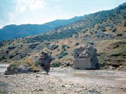
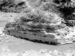
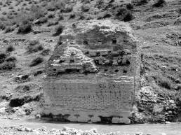
During our visit to the monument in 1980, we saw the remnants of its right-bank and middle piers still preserved on both sides of the river. It was entirely built of brick, except its main parts, which were laid with finely-dressed large blocks of basalt stretching in regular rows.
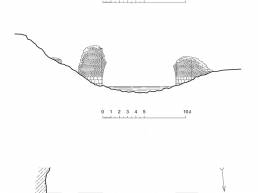
Span length: 8.80 metres; passage width: 4.23 metres; geographical coordinates: N 40°49°59.18,°° E 45°40°40.49.°°
